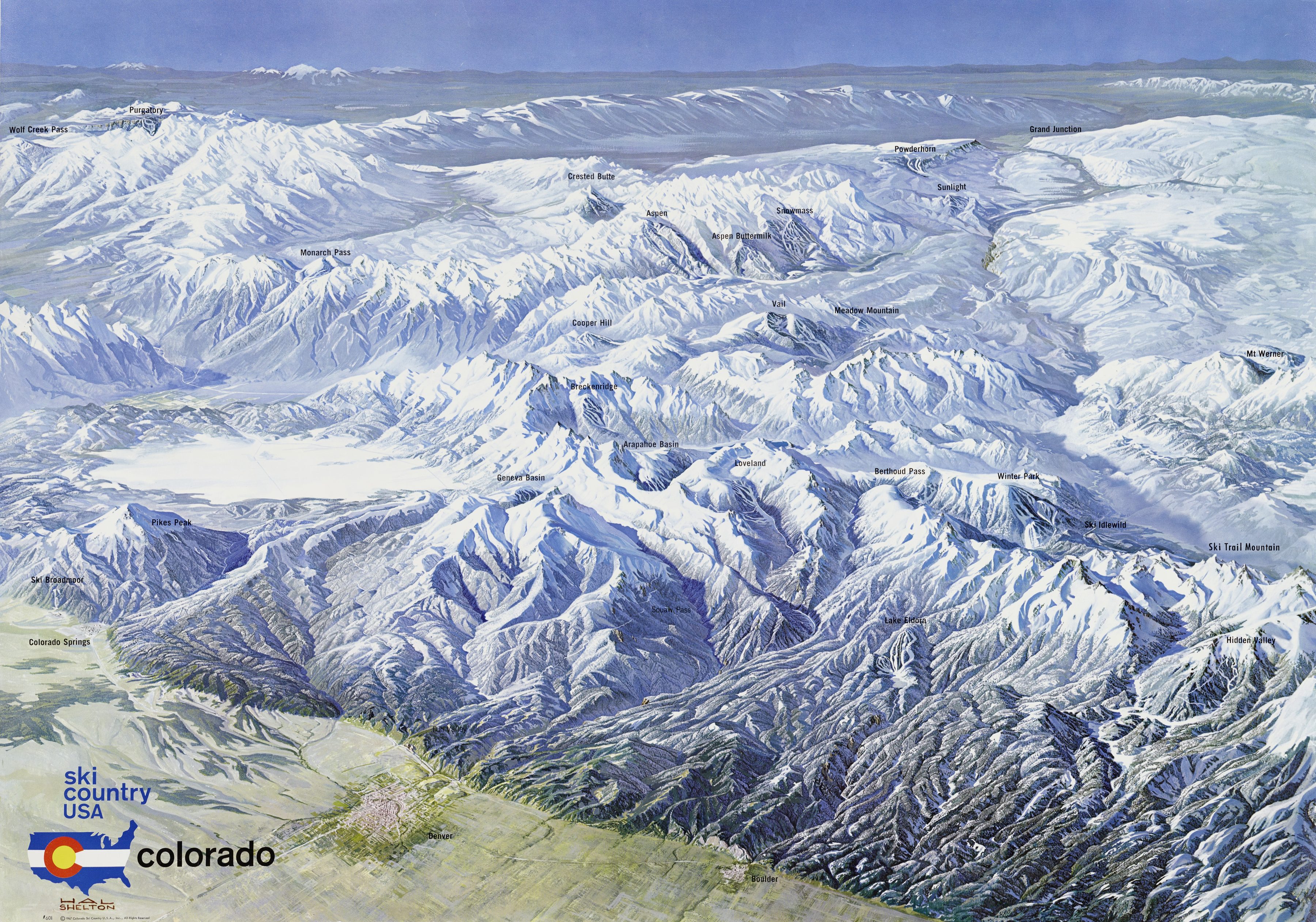
The original · 1967
Ski Country USA — Colorado
Painted in 1967 for Colorado Ski Country USA, the state's ski-industry association, the panorama looks south-west from high above the plains near Denver, across the Front Range and the Continental Divide to the San Juans on the horizon. It marks the ski areas of the day, from Vail, Aspen and Winter Park to hills like Geneva Basin and Meadow Mountain that have since closed.
Hal Shelton (1916–2004) trained as a scientific illustrator and worked for the U.S. Geological Survey and later Jeppesen, where he pioneered natural-colour relief maps painted with airbrush and acrylic glazes instead of contour lines. He went on to paint early trail maps for Alta, Jackson Hole, Winter Park and many other resorts, and his style shaped how ski areas have been drawn ever since.
This map is a digital reinterpretation of Shelton's famous panorama: today's ski areas on real USGS terrain, seen in 3D from his viewpoint and painted to echo his palette.
Painting: Hal Shelton, Ski Country USA – Colorado, 1967. View full size